
The Provo/Orem area has some of the most beautiful terrain in the country, which is exactly why the Utah Valley Marathon has become a popular event. Many visitors to the area don’t realize that there are hundreds of trails in the area that are well-manicured and safe for running. If you are a resident or simply visiting the area, we have our top four trail running recommendations for you.
If you are a visitor to the area, please remember our elevations and weather are different than most places. Snow and ice may linger well into spring and begin early in the fall. It’s always a good idea to discuss trails and conditions with locals who are familiar with the area.
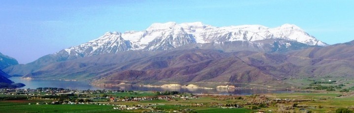
Bonneville Shoreline Trail, Provo Canyon Section
Orem, Utah
Length: 5.4 miles
Elevation: 698-foot ascent, 687-foot descent
This trail is consistently rated one of the top trails for running and biking in the area. The trail begins at East Lawn Cemetery and has parking available off Timpview Drive. The trail flows through the foothills, into Provo Canyon, merging with Provo River Parkway near Bridal Veil Falls. The trail is dirt, but easy to follow. There are a few difficult climbs, as well as a few rough areas that require walking. Runners estimate only a 9% section where walking is necessary.
Squaw Peak Trail
Provo, Utah
Length: 2.1 miles
Elevation: 1,649-foot ascent, -56- foot descent
This trail is not for the faint of heart, considered difficult by even the most skilled runners. If you can survive the run, the views are worth it. Near the Provo Temple, follow the Rock Canyon Trail, then fork left onto Squaw Peak Trail. The trail will take runners up a few steep ascents. The elevation of this hike is 7,798-feet, so if visiting during spring or fall, runners may encounter a little snow.
Slate Canyon
Provo, Utah
Length: 11.2 Miles
Elevation: 3,442-foot ascent, 3,441-foot descent
This is another tough trail, with a nearly 3,500-foot ascent. The trail is rocky and has areas that require walking or extra care. Begin the trail at the Slate Canyon Trailhead in Slate Canyon Park. Take the trail to the left, don’t head up the canyon, as that’s where you’ll come down. Much of the run is through trees or meadows. Depending on the time of year, this trail features numerous creeks and areas of water.
Bridal Veil Falls
Provo, Utah
Length: 1.3 Miles
Elevation: 124-foot ascent, 124-foot descent
This trail is easy and great for the entire family. The trailhead is located off Highway 189, 3.6 miles up Provo Canyon. There is a turnoff with signs taking you to a parking lot down the road. The trailhead begins on the other side of the Provo River bridge. The trail is paved and is popular for bicyclists also, so stay to the right. The trail will take you down to Bridal Veil Falls. If you are in the mood for a quick jaunt or have small children with you, this is the trail for you.